Actualités
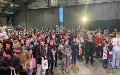
Les jeunes normands confirment leur attrait pour le secteur aéronautique : 682 collégiens et lycéens sont reçus au BIA 2026
Rouen, le 8 juillet 2026 – Diplôme de l’Education Nationale, le Brevet d’Initiation à l’Aéronautique (BIA) est le premier diplôme de la filière aéronautique en France. Véritable tremplin pour faire découvrir aux jeunes le monde de l’aéronautique et leur permettre...
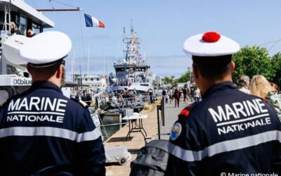
La base navale de Cherbourg célèbre les 400 ans de la Marine
La Base navale de Cherbourg a fêté le 13 juin dernier le 400ème anniversaire de la Marine. Sous un soleil radieux, des élèves des écoles militaires de Querqueville et de la Préparation militaire de Cherbourg ont défilé depuis le centre-ville entraînant derrière eux un...
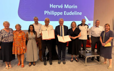
La Région Normandie renouvelle sa confiance à la filière NAE avec la signature d’un nouveau contrat triennal
Rouen, le 26 juin 2026 – Ce nouveau contrat triennal a été officialisé par Hervé Morin, Président de Région, à l’issue de l’Assemblée Générale de NAE qui se tenait le 25 juin au mémorial de Caen. Organisées le même jour, les élections du Bureau ont renouvelé Philippe...
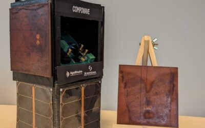
Apollinaire et Scienteama nouvelle génération de structures RF intégrées
Dans le cadre de leurs activités de recherche et d’innovation, Apollinaire Composites & Technologies et Scienteama ont engagé une collaboration visant à intégrer des fonctions radiofréquences directement au sein de structures composites haute performance. Baptisé...
Aria Seprolec investit dans de nouvelles capacités industrielles
Ces quatre derniers mois, Aria Seprolec a franchi une nouvelle étape dans le développement de ses activités en réalisant des investissements significatifs en matière de capacité de production, mais aussi de qualification sur des hautes technologies : Défense/Spatial....
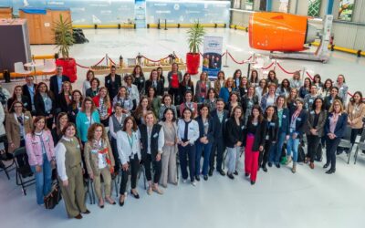
Safran Nacelles accueille l’International Aerospace Womens Association sur son site toulousain
Le 17 avril, Safran Nacelles a accueilli l’International Aerospace Womens Association à Colomiers pour un événement dédié au leadership féminin dans l’aéronautique. Environ 70 talents féminins provenant de grandes entreprises du secteur (Airbus, Thales, Pratt &...
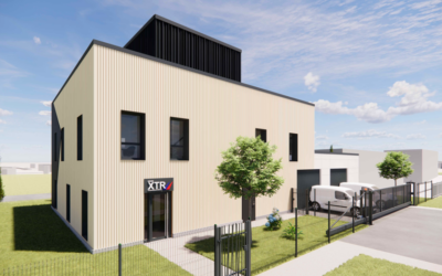
Drone XTR : 2 millions € dans un nouveau bâtiment au Havre
Ce site renforcera ses capacités de R&D, de production et de services opérationnels en Normandie. Il comprendra notamment une chaîne de montage, un banc d’essais, une salle anéchoïque et un centre de contrôle opérationnel. L’objectif est de réduire les délais de...
Prochaine édition RUNWAY le samedi 26 septembre 2026
Une nouvelle fois, le tarmac de l’aéroport du Havre se transformera en terrain de jeu unique pour une expérience sportive hors du commun, toujours dans une ambiance conviviale, festive et accessible à tous. Ne tardez donc pas à réserver votre soirée et rejoindre...
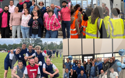
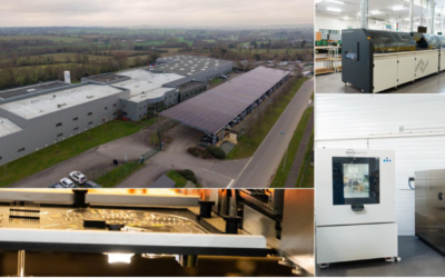
Calip Group une industrie engagée sur ses territoires
Chez Calip Group, la performance industrielle s’accompagne d’engagements concrets en matière de responsabilité sociétale et environnementale. Le groupe poursuit ses investissements pour réduire son impact environnemental avec l’installation de panneaux...
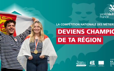
Repérez et soutenez les talents de demain avec WorldSkills
La compétition WorldSkills France revient en Normandie pour sa 49e édition… et les inscriptions sont ouvertes ! Véritable vitrine de l’excellence professionnelle, cette compétition permet à de jeunes talents de démontrer leur savoir-faire et de se dépasser, du niveau...
